views
Google Maps tells you directions, helps you navigate around the city by giving you real-time traffic updates, and even shows you public transport in the area. And now, Maps is getting another much-needed feature that tells you about the air quality in the city, or other parts of the country. The air quality index or AQI is the measuring standard for air quality, and Maps is giving you details about the AQI levels in your city.
Maps already give you a host of features, and adding air quality felt inevitable. The option is available for both iOS and Android phone users now, and there is not a lot to do over here.
Also Read: Apple Headset For AR And VR Is Launching In January Next Year: Kuo
How To Get Air Quality Details On Google Maps
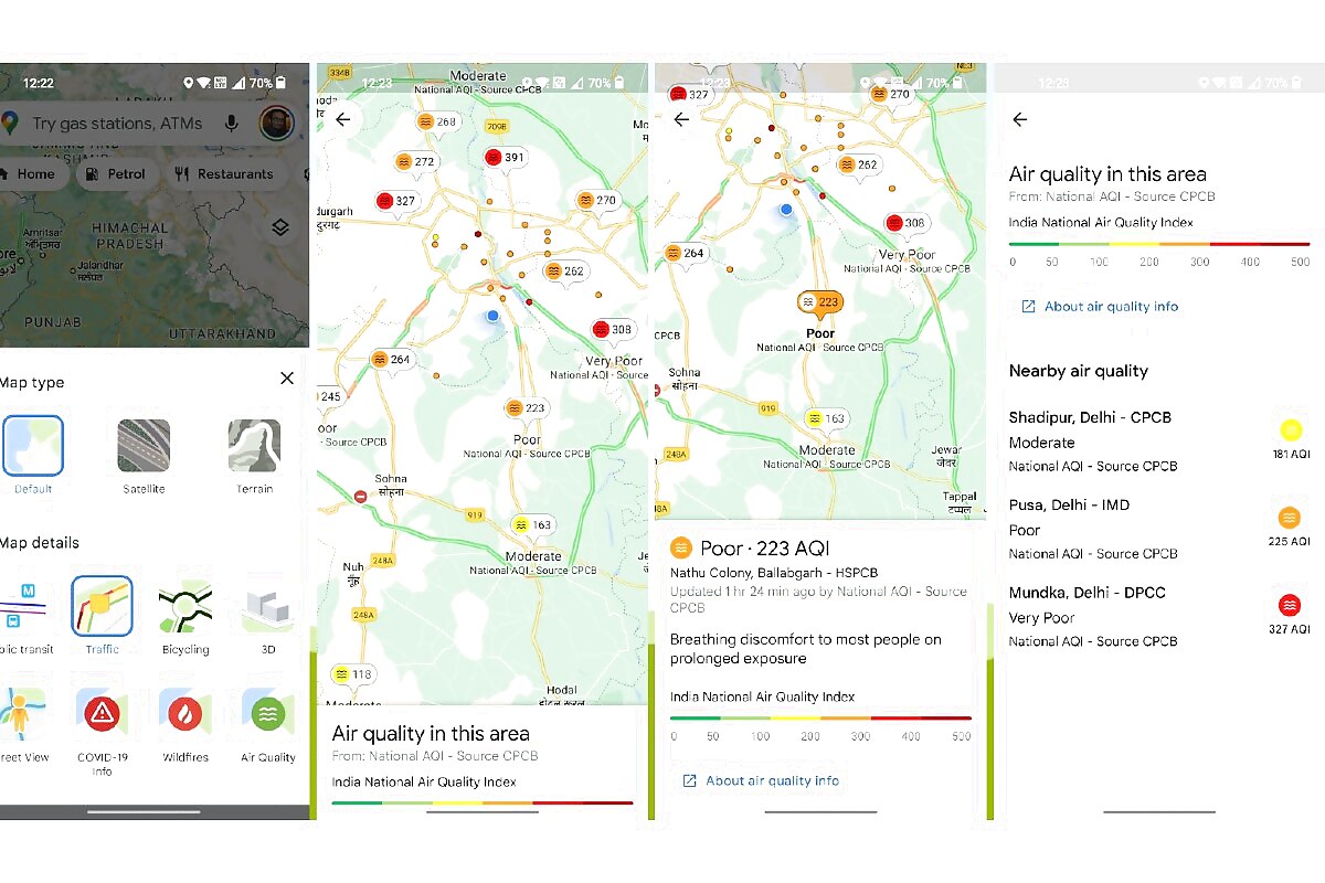
You just have to follow these simple steps to get air quality data on Maps for your smartphone.
– Go to Google Maps
– Tap on the box icon in the middle-right
– Click on Air Quality to change the feature on the Maps
– Tap on any AQI bubble to get full air quality data for the city/region

Air quality has become a serious issue across many parts of India, especially during the latter part of the year when the air quality deteriorates badly in the country. Google says it is sourcing the data from the National AQI reader provided by the Central Pollution Control Board or CPCB.
The feature gives you AQI levels from 0 to 500 which is measured in green colour to dark red, which shows the severity of the pollution in the air. Currently, you can only see the AQI readings, along with the quality of the air giving you advice on whether you should risk stepping out or avoid it.
Also Read: Instagram Now Allows You To Pin Three Posts On Top Of Profile Grid: Here’s How To Do It
It is likely that Maps will add human inputs to the Air quality feature so that people can crowd-source AQI data in areas where the data is not available to the national body.
Read all the Latest Tech News here


Comments
0 comment