views
Cauvery Delta Region/Nagpur: It wasn’t an age to suffer a heart attack. Veermani was only 35 when his end came.
“We were on the field when he collapsed and died,” his widow Kavitha told us at her home in February 2017, wondering how her husband could die of a heart attack at such a young age. He was fit and fine, she says, but in a lot of stress and tension. Nothing was left of the farm – it wore a forlorn look, she says.
On December 30, 2016, Kavitha said, they went to their farm – a 1.25 acre plot that this landless Dalit family had leased for the first time from a fellow villager – to tend to the crop, or whatever was left of it.
Around 4 pm, she saw him falling. “When I ran to check what the matter was, he was not responding to my calls,” she said. She called for the help and took him to the nearby cottage hospital in an ambulance. He had already passed out, the doctors told her. He had died instantly of heart attack.
It was, doctors told her, a shock death – something she hadn’t been able to fathom.
“It did not rain this year; it was our bad luck,” she recalled. “It was the first year we decided to lease land for our sustenance, and it turned out to be the worst year for farming.”
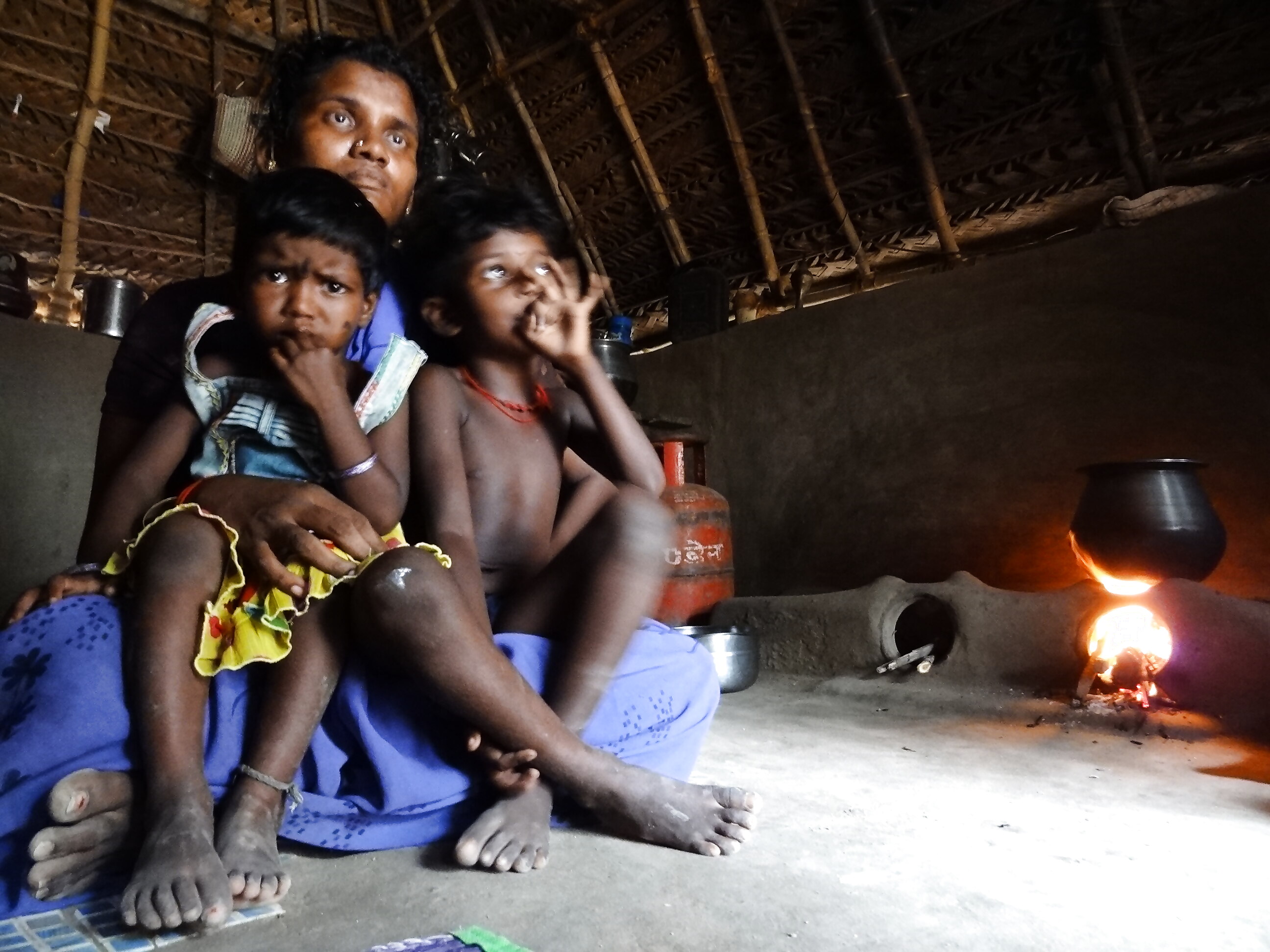
(Kavitha - is the widow of Veermani)
Veermani and Kavitha would toil on others’ farms every year, make wages, and dream of having their own farm in a region that was once known for three-crop lands.
In 2016-17, the summer and winter plantation seasons failed, not just in Kavitha’s Kadamankudy village in Nagapattinam district in the far-eastern tip of the Cauvery delta, but across Tamil Nadu.
Veermani was not the only farmer to have died of shock – the state had registered over 200 such farmer deaths between October 2016 and January 2017 in addition to suicides by the peasants.
As many as 106 farmers were reported to have committed suicide in one month, according to a notice issued by the National Human Rights Commission to the state government on January 5, 2017.
That sparked vitriolic protests across the state and also in New Delhi.
The Cauvery Delta, a region that has been the seat of power and culture for ages and where the process of civilization is several millennia old, has been witnessing agrarian distress for some years, something of an unprecedented scale not seen or heard in this once-prosperous region in the last century.
Friday’s Supreme Court judgement on Cauvery waters that reduced the Tamil Nadu’s share of water and increased Karnataka’s share in the river, many experts feel, would exacerbate the problems in the Delta. The Supreme Court has said Tamil Nadu can dip into ground water.
The crisis however goes beyond the water sharing or the Supreme Court case; it actually is a mix of many man-made factors aggravated by climatic aberrations that have had a cascading impact on the Delta’s unparalleled water distribution system – a system created over many centuries that stands to be threatened for extinction.
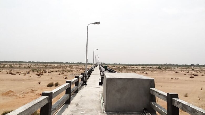
It’s a full-blown water crisis that the prevailing drought in Tamil Nadu has bared and as local farmers say, it threatens to steadily destroy the water system unique to the Cauvery delta.
The Unparalleled Cauvery Delta System
Several tributaries, branch-canals and innumerable channels form a network in the Cauvery delta that is unparalleled not just in India, perhaps the world – part natural, part manmade built over millennia.
This web of surface water system that satiates every inch of the Delta – the very root of the civilizational growth – is under threat as spatial-temporal anthropogenic causes coupled with climatic aberrations are hurting the river ecology, says V Deivasihamani, a retired assistant engineer with the Tamil Nadu Public Works Department with over 40 years of experience in the Delta’s water works. “This is a serious crisis,” he said.
Cauvery, the largest of the rivers in South India, originates from the southern tip of the Western Ghats in Karnataka and joins the Bay of Bengal.
About a couple thousand years ago, according to various studies, a Chola King built a stone-dam, which is popularly called the Grand Anicut in what is now Thiruchirapalli district. The Delta begins from here.
The Cauvery actually splinters into five rivers at the Grand-Anicut, including a large drainage cum river called the Kollidam (Cooleroon, as the British would call it) which again merges into Cauvery a few miles eastward and forms a huge Cauvery river that meets the Bay of Bengal further east of Chidambaram.
The Delta gets rains during the North-East monsoon – October to December. But this is more often erratic and undependable, the coastal areas and the Delta occasionally receive heavy intense rains of very short duration, most of which can be neither conserved nor utilised in the delta.
Traditionally, Tamil Nadu depended on the flows of Cauvery from June onwards during the South West monsoon and on local rainfall during the North-East monsoon.
After the commissioning of Mettur Reservoir in 1934 it became possible to impound excess flows and send down regulated discharges to meet the needs of the river channels and the delta.
The design map of Cauvery and her distributaries and their innumerable canals resembles a horizontal funnel with its tip at the Grand Anicut and mouth spread across the coastline in the Delta and a massive web of veins-like serpentine river and canals flowing waters to the villages and towns all over.
“As much as 15 lakh acres of farm land in the Delta was once irrigated by this structure for three crops,” explains S Ranganathan, the octogenarian farmer leader in Mannargudi town who first moved a petition before the Supreme Court three decades ago pleading for a settlement of dispute with Karnataka on the Cauvery water share of Tamil Nadu. “It’s down to one crop in many places now,” he says. “Terrible!”
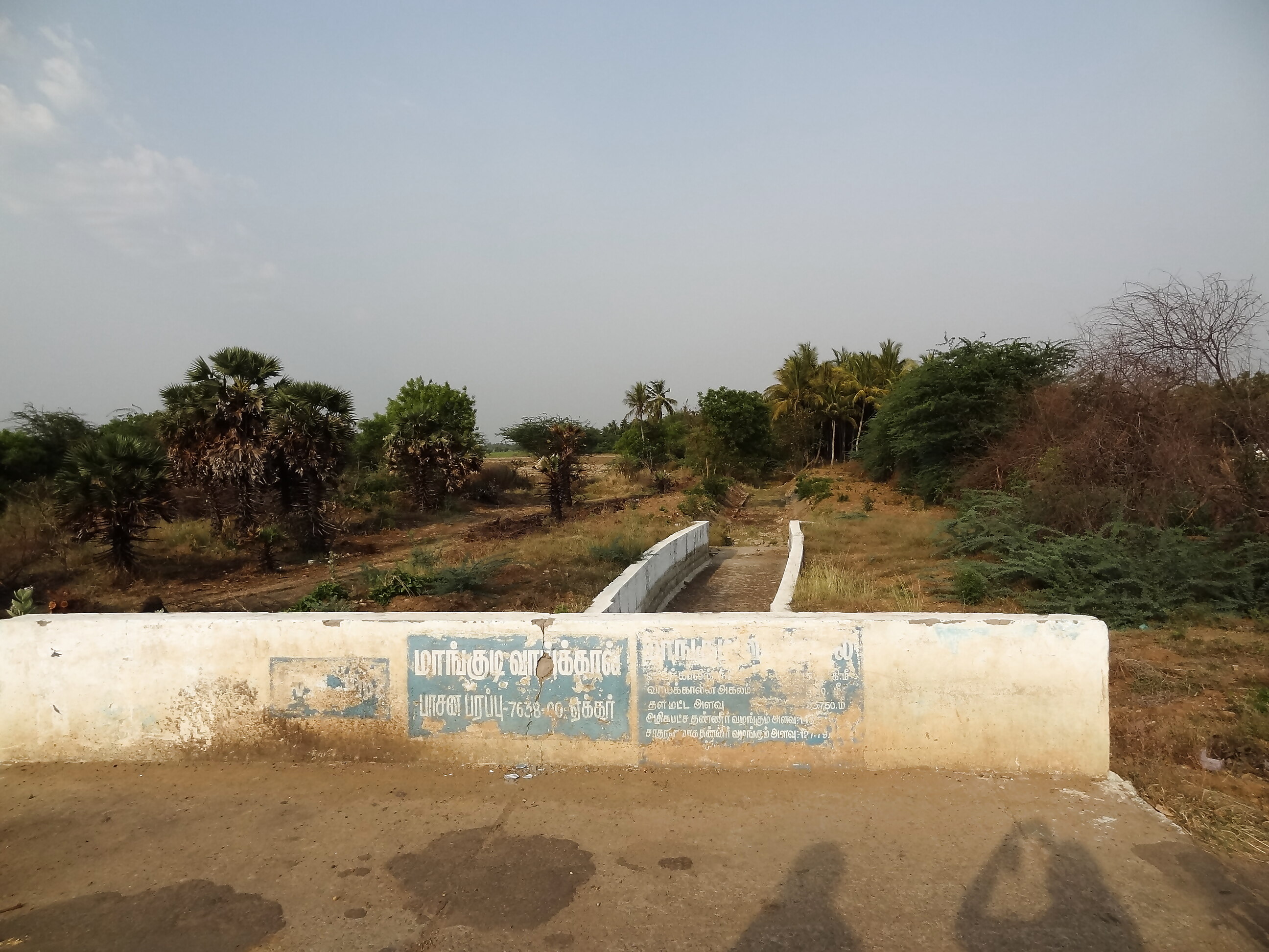
Dry Mannargudi channel
The general secretary of the Cauvery Delta Farmers' Welfare Association, Ranganathan says Delta is the only region that is in the plains in the river’s journey. “If stretched into one line the channels will cover 65 per cent of the Earth’s equator,” he says. This region actually produces paddy for not only Tamil Nadu but also to meet the requirements of Kerala. “The entire water was at our disposal when there was no development of irrigation in Karnataka and Kerala; the history of this region is as old as that of Greeks.”
As the distributaries fall silent, farmers are feeling the pinch – migrations have begun, from the Delta to the bigger cities like Chennai in what is in contrast to the in-migration trends of this region.
The delta produced best of the food – from natural millets to paddy to fruits and vegetables – round the year. But as Karnataka began to impound water in Cauvery and its tributaries in the up-stream regions in its territory in keeping with its obligation for its own farmers, the flow of waters downstream suffered.
Add to it the expansion of new metros and their water requirements and you get a vexed dispute.
Drying up of the ancient system
Until the modern dams were built, Cauvery brought the entire surplus water from its massive catchment to the Delta region, where it splinters into five sub-rivers, 37 tributaries, 1505 A-class channels, about 30,000 B-class channels, and innumerable C and D class channels. In addition to this: the river has about 22 major drains and 600 minor drains, which pour surplus waters into the sea in the times of floods, as the data with the water works section of the state PWD shows. Together, this network runs into several thousand miles of surface water routes that irrigate roughly 15 lakh acres of land in the delta region fed by three basins, that of Cauvery, Venar sub-basin and the new Grand Anicut canal created after 1934.
Add to it some 40,000 ponds or village reservoirs – and you have a massive storage of water.
This system brings water to every farm in every single village. Today it’s completely dry – rivers, rivulets, channels, canals, drains, ponds, every structure is dry. The ground water table across the delta is falling alarmingly as struggle for water intensifies. The delta has no other source of water if Cauvery runs dry.
“The drought has sparked conflicts over ground water,” 53-year-old A Dakshinamoorthy, a three-acre paddy grower in village Mangudi in Thanjavur district, told us in March 2017.
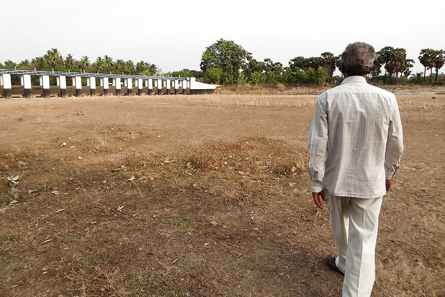
Former Public Works and Irrigation Employee A Deivasihamani showing the dry Venar river, a tributary of Cauvery in Thiruchirapalli district
Bore-well digging in the village had intensified, he revealed, as old bore-wells, not very deep, ran dry.
We met Dakshinamoorthy at a culvert underneath which was a regulator on Mangudi channel, one of the many channels that branched out of the Cauvery sub-river, Vennar, to bring water to Mangudi.
At that point, the channel was dry. Because the Venar, its feeding river was dry. Venar was dry because the Cauvery was dry. The Grand-Anicut, an important reservoir that releases the surplus water flowing from the upper catchment, was dry. This dam was dry because two important reservoirs that the British built in the 1930s, the Upper Anicut and the Mettur dam (with the capacity of storing 95 TMC water) had run dry. They were dry, because the entire upper catchment in Karnataka was dry, due to a biting drought following failed rains.
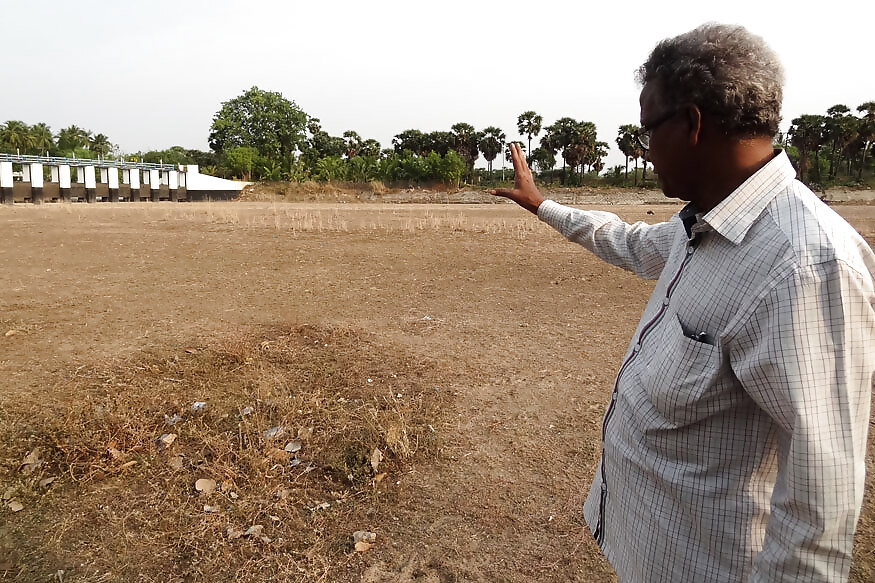
This entire system of flow or surface irrigation, the backbone of the Delta prosperity, is under threat for a combination of factors: the south-west surplus water that comes to this part from upper catchment in Karnataka has been severely affected due to successive years of drought in that part, failure of monsoon for the last several years, and development of new dams and reservoirs in the upper stretches; failure of north-east monsoon; increasing salinity along the coastal areas; and over-exploitation of ground water.
The Mangudi channel had the potential to irrigate 7638 acres of land, the info marked on the regulator said. The channel’s head is upstream of the Nadar regulatory on the Venar River, a few metres down the basin. Deivasihamani explained to us the system of discharge of water through its approach channel; the minimum and maximum levels to be maintained in the Mangudi channel; and normal level of water discharge through two vents of the sluices that would irrigate farms and re-charge wells and bore-wells in a regular monsoon year. “All this is useless if the network is without water,” he said.
A number of regulatory controls like these have been built in the delta to regulate the canal supply. This, however, depends on the availability of supplies. In the delta a short-term crop called ‘Kuruvai’ is raised between the months of June and September followed by a medium-range crop called ‘Thaladi’ between October and February. In single crop dry-lands in other parts of the state, long-term crop ‘Samba’ is raised between July and January. Rice dominates the landscape in the delta, mainly the temple district of Thanjavur. Tamil Nadu’s political economy of rice largely depends on this District, nay the Delta. The alluvial soil of the delta is ideal for growing rice, and in isolated pockets, sugarcane.
Cauvery Journey
The first important tributary to join the Cauvery, practically on the border of Coorg and Karnataka districts, is Harangi. Other smaller tributaries like Kakkabe, Kadamur and Kummanhole join and continue to flow eastwards. Two important tributaries i.e. Hemavathy and Laxmanthirtha join Cauvery later.
After it flows further eastwards below Krishnarajasagar dam it is joined by another important tributary Kabini. Thereafter, two tributaries – Suvarnavathy from the north and Shimsha from the south – join the Cauvery. After Sivasamudram it passes through the hilly tracts and its width narrows down considerably.
At places it has to pass through gorges. After flowing through the gorge, the Cauvery continues its journey towards East and in that process it forms the boundary between Karnataka and Tamil Nadu for a distance of about 64 km. (40 miles). Yet another tributary i.e. Arkavathi joins the river just before it enters Tamil Nadu State. 2. At Hoganekal falls along the common border, the river takes its course towards South and enters the well-known Mettur reservoir in the State of Tamil Nadu. Thereafter its further journey continues.
The Bhavani river joins it on the right bank about 45 km. (28 miles) below the Mettur reservoir and it enters the plains of Tamil Nadu where more tributaries, the Noyil and the Amaravathy join. Immediately below the Upper Anicut, the river splits into two branches. The northern branch is called 'Coleroon' and the southern branch retains its original name. The Upper Anicut was constructed in the year 1886 to facilitate diversion of the low supplies of the river into Cauvery delta.
The two branches join again forming Srirangam Island. It is said that Chola King constructed the Grand Anicut at the junction point below the island aforesaid which formed a great irrigation system in the Thanjavur district in the first century A.D. There is further split of the Cauvery; into two branches- one being called Cauvery and the other Vennar. The channels are used as canals for irrigating the fields in the Cauvery delta. Regulators have been provided to regulate the supply of water for distributing the Cauvery waters in the delta. The branches divide and sub-divide into innumerable smaller branches.
The Karnataka Government proceeded with the construction of Kabini Reservoir from 1958 onwards and completed in 1975. The reservoir as executed has a live capacity of 16 TMC; the ultimate Ayacut and utilisation under the reservoir are reported to be 4.54 lakhs acres and 57.7 TMC respectively. The irrigation from the reservoir has commenced from 1975-76 onwards.
The construction of the reservoirs upstream in Karnataka has affected the inflows into Mettur Reservoir.
Cauvery is the only major river in Tamil Nadu which has been contributing nearly 50 percent of the State's surface water use. The upper part of the Cauvery basin above Mettur is influenced by south-west monsoon, while the lower part is influenced by North-east monsoon. The flow of the river during the south west monsoon is, to a very great extent, dependent on the run-off from the hilly catchment above the Sivasamudram falls. The South West monsoon is more intensive, unfailing and dependable, spread over a long period. During this period, most of the catchment lying below the Mettur reservoir gets practically no benefit excepting a small portion of the high ranges of the Bhavani and Amaravathi tributaries, as the catchment lies on the rain-shadow area of Western Ghats.
Jaideep Hardikar is a Nagpur-based journalist, and a volunteer for the People’s Archive of Rural India (PARI)






Comments
0 comment