
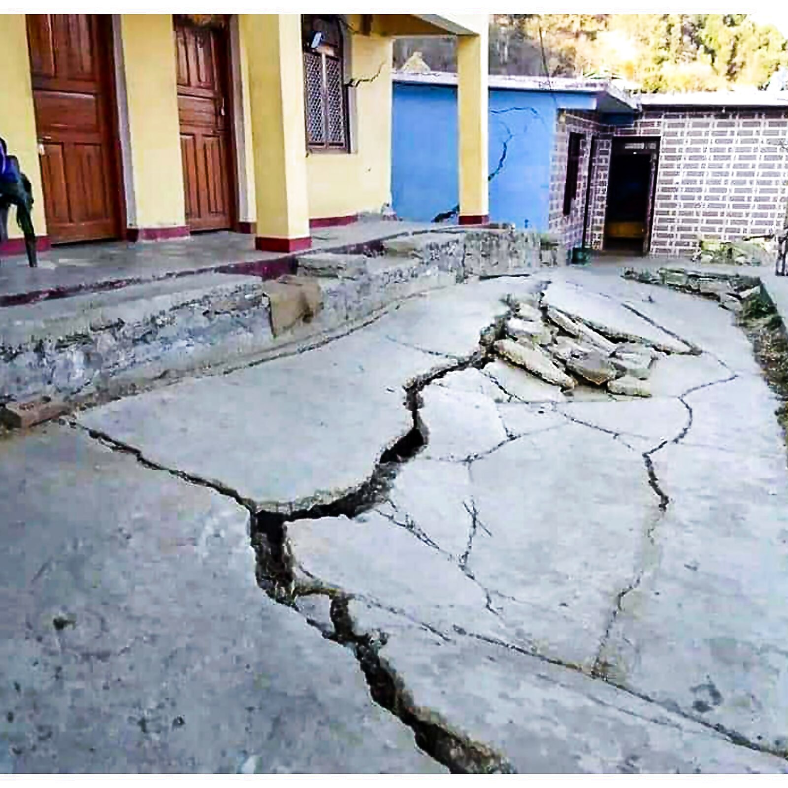
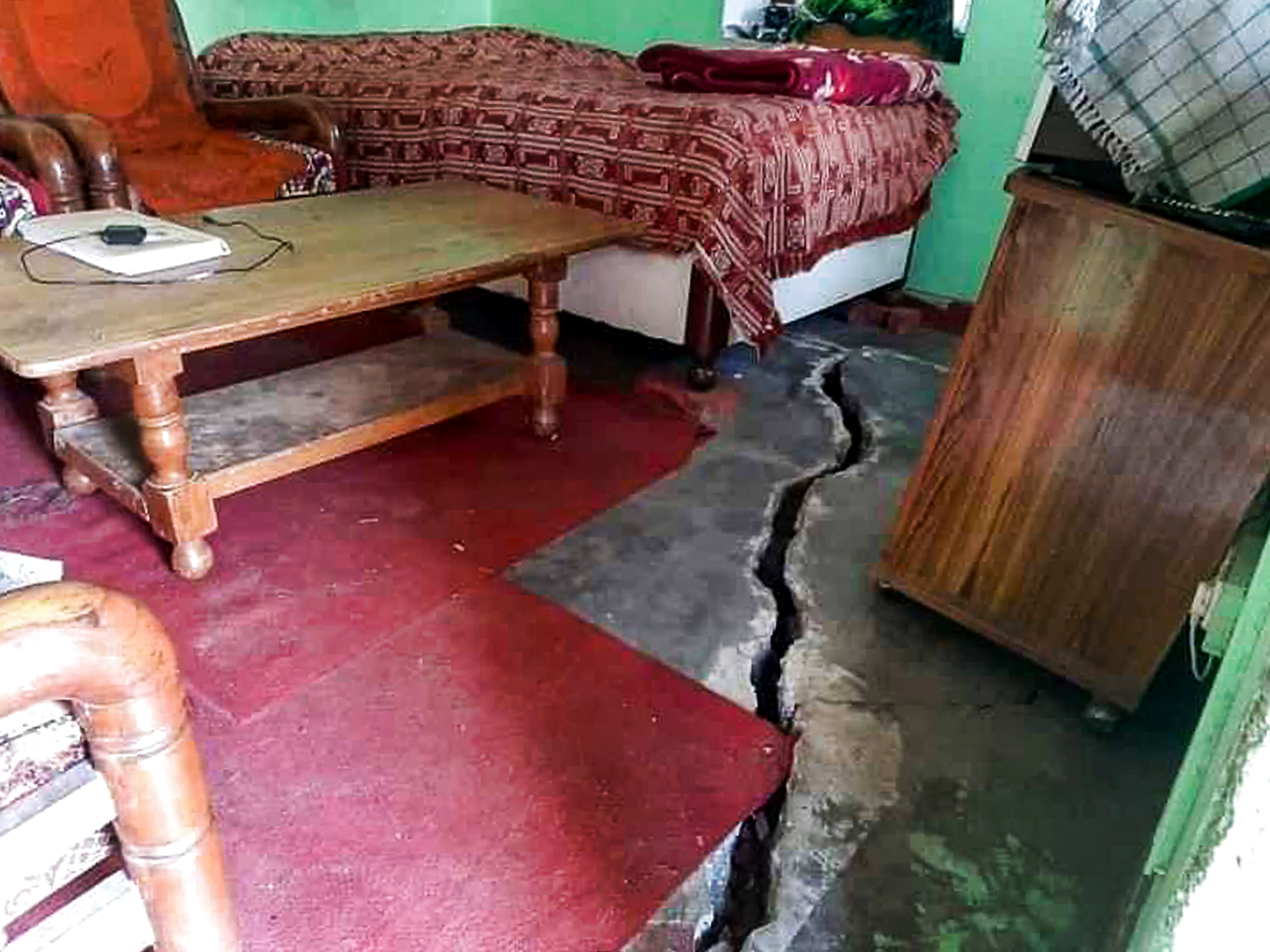
Joshimath has been declared a landslide and subsidence-hit zone, with the Centre emphasising that the immediate priority is the safety of people and asking experts to prepare short and long-term conservation and rehabilitation plans.
Senior Uttarakhand government officials visited the worst-affected Manohar Bagh, Singdhar, and Marwari areas and urged residents to relocate to temporary relief centres. And the administration is working to relocate more families living in houses with large cracks to safe locations.
As efforts remain on, it’s essential to understand what is happening at Joshimath, especially what land subsidence is, and what causes it.
What is Land Subsidence?
Subsidence is ground sinking.
It is caused by underground material movement, but is most commonly caused by the removal of water, oil, natural gas, or mineral resources from the ground through pumping, fracking, or mining activities.
Natural events such as earthquakes, soil compaction, glacial isostatic adjustment, erosion, sinkhole formation, and adding water to fine soils deposited by wind can also cause subsidence (a natural process known as loess deposits), explains a report by the National Oceanic and Atmospheric Administration (US).
Subsidence can occur over very large areas, such as entire states or provinces, or over very small areas, such as a corner of your yard.
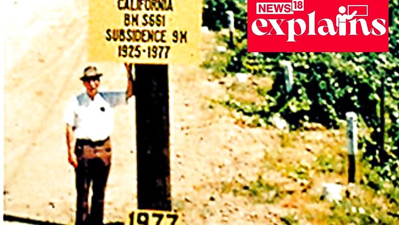
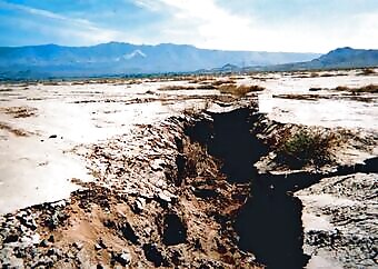
A picture shared by the United States Geological Survey shows what land subsidence can do. Take a look:
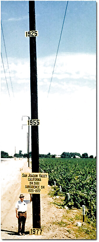
In this photo, Dr. Joseph F. Poland’s research efforts identified the approximate location of maximum subsidence in the United States. Signs on the pole indicate the approximate altitude of the land surface in 1925, 1955, and 1977. The location is southwest of Mendota, California, in the San Joaquin Valley.
What is the Most Common Cause of Land Subsidence?
Compaction of soils in some aquifer systems can occur as a result of excessive groundwater pumping, and it is by far the most common cause of subsidence, the report by USGS says.
Excessive pumping of these aquifer systems has caused permanent subsidence and ground failures. When large amounts of water are pumped into some systems, the subsoil compacts, reducing the size and number of open pore spaces in the soil that previously held water.
This can result in a permanent reduction in the aquifer system’s total storage capacity.
What’s Happening in Joshimath?
Land subsidence was also reported in Joshimath in the 1970s.
A panel chaired by Garhwal Commissioner Mahesh Chandra Mishra submitted a report in 1978 stating that major construction work should not be carried out in the city and the Niti and Mana valleys because these areas are located on moraines, which are masses of rocks, sediment, and soil transported and deposited by a glacier.
Joshimath, according to the book ‘Central Himalaya’ by Heim, Arnold, and August Gansser, is built on landslide debris.
In 1971, a few houses reported cracks, prompting a report that recommended some measures, including the preservation of existing trees and the planting of more trees, as well as the preservation of the boulders on which the town is built. However, there are claims that these measures were never implemented.
“The ongoing crisis in Joshimath is primarily the result of human activity. The population has grown dramatically, as has the number of visitors. Unchecked infrastructure development has occurred. Blasting is used to build tunnels for hydropower projects, causing local earthquake tremors and shaking debris above the rocks, leading to cracks,” experts told PTI.
Famous Examples of Land Subsidence
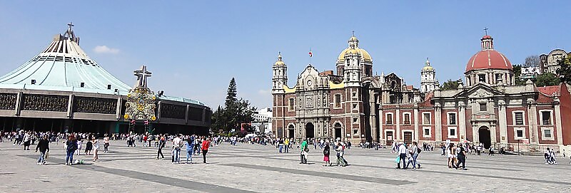
The old Basilica of Our Lady of Guadalupe’s sinking foundation is clearly visible as it stands next to Cachupin Chapel in Mexico City. Long-term groundwater extraction has resulted in significant land subsidence and aquifer-system compaction, causing damage to colonial-era buildings, buckled highways, and disrupted water supply and waste-water drainage. Some buildings were deemed unsafe and were closed, while many others required repairs to remain operational, the USGS report explains.
Groundwater withdrawal near Lucerne Lake (dry) in San Bernardino County, Mojave Desert, California has caused land subsidence, resulting in the formation of fissures on the landscape.
The fissures were up to 1 metre (3.3 feet) wide and deep in some places. Fissuring is frequently associated with localised differential sediment compaction.
Read all the Latest Explainers here


Comments
0 comment